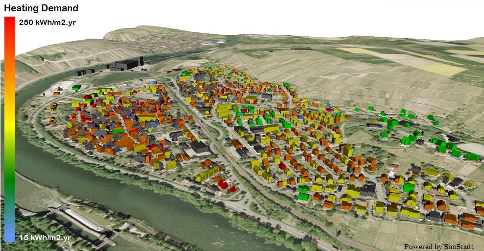
City 3D digital models to share, view and analyze urban spatio-semantiques data, the scale of the material to the territory. Multidomaines, they are used for various applications: noise modeling, simulation of flooding studies behavioural and socio-demographic, energy epidemiology...
Where the "Building Information Models" (BIM) stop at the end of the garden, digital 3D city models take into account the phenomena of urban interactions, such as the urban heat island and the sharing of applications and energy production of the buildings.
Planners, municipalities and energy providers have information to decide and coordinate the best strategies, combining low CO2 emissions and profitable investments.
Complete diagnostic instruments, these models allow to identify the priorities of renovation building by building and predict their potential for energy savings. -Territorial climate energy plan - energy strategies can thus be planned across the city, combining a reduction in energy demand and the best use of the potential of renewable energy.
One of the main challenges of these numerical models of city is the collection and data sharing. The availability and quality of these data directly impact the reliability of the energy analysis. While 3D urban geometries can be generated automatically and precisely using laser technologies or photogrammetric, the collection of semantic information related to the buildings and their uses is more complex and laborious. She asked to come across many sources of information and to use more or less automatic data acquisition methods.
It is essential to have a model of digital city unique, open, multidomain and multi 'level of detail', which could serve as a platform for Exchange of data between different urban actors.
The CityGML standard meets these criteria. It is an international reference, already used to model settlements in France (Lyon, Rennes) and Europe (London, Stuttgart).
Original version of article: review of the Centraliens, jan. 2015.

